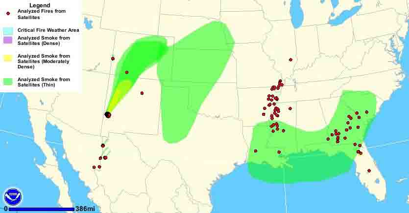
Map showing smoke from wildfires in New Mexico and Colorado - 11:18 a.m. MDT, May 26, 2012. NOAA
Some residents of Colorado are detecting a strong odor of smoke and are assuming that there is a nearby fire, but depending on their location, it is most likely coming from the Whitewater-Baldy fire in western New Mexico.
However, there is a new rapidly spreading fire in western Colorado 46 miles southwest of Grand Junction, and 4 miles northwest of Paradox, Colorado burning on both sides of the Colorado/Utah border. That fire, the Sunrise Mine Fire, is being affected by south or southwest winds at around 20 mph gusting to about 40 mph according to data from nearby weather stations. Saturday morning the National Weather Service?issued a Red Flag Warning?for western Colorado which will be in effect until 9 p.m Saturday night. Their forecast includes south winds of 30 to 40 mph with gusts up to 60 mph below 8,000 feet, and up to 75 mph on exposed ridges above 8,000 feet. The relative humidity should be 10 to 15 percent.
A spot weather forecast issued for the fire Saturday morning predicted increasing winds throughout the day, maxing out at 20 to 30 mph gusting at 50 to 60 mph by 3 p.m.
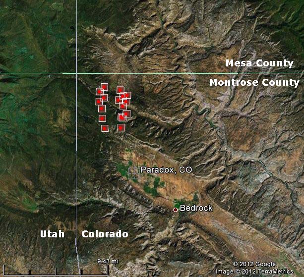
On the map above the small dot on the UT/CO border is this new fire. The coordinates of the fire are?N38.288N W108.5920 . More details are on the map below.

Map of Sunrise Mine Fire, shows heat detected by satellites at 11:49 p.m. MDT, May 25, 2012
The size of the Sunrise Mine fire is approximately 2,800 acres. A Type 1 Incident Management Team has been ordered.
?
No comments:
Post a Comment
Note: Only a member of this blog may post a comment.